REVIEW · ALMATY CITY
Almaty: Advanced Hiking – Four Peaks Hike
Book on GetYourGuide →Operated by Temirlan_guides · Bookable on GetYourGuide
Some hikes near Almaty are pretty. This one is serious. You’ll tackle four iconic summits in the Ile Alatau, with constant ridge travel and big panoramic rewards, starting from the Kim Asar Valley and working your way toward Chimbulachka. Two things I really like about this experience are the private guide (full route control and pace tailored to you) and the safety setup (GPS navigation, trekking poles, and winter crampons when needed). One drawback to think about up front: this is an advanced day with up to 2,000 m of elevation gain, so it’s not for low-fitness hikers.
The route is also longer than it looks on a map: about 11.5 km, often taking 8–10 hours, with frequent altitude pressure on your legs and lungs. In other words, you’re not just “walking in mountains,” you’re doing a proper summit day with a continuous workload—then finishing with a cable car ride from the Shymbulak area. If that sounds fun, great. If you’re hoping for an easy stroll and quick photo stops, you may want a gentler hike instead.
In This Review
- Key points worth getting excited about
- Four Peaks Near Almaty: Why This Is the Real Challenge Day
- Kim Asar Valley to the Mountain Swings: Your Start Is the Warm-Up
- Furmanov to Panorama: The Ridge Feels Like a Checklist of Views
- Bashuta and Chimbulachka: The High Points That Make the Day Worth It
- Shymbulak Cable Car Finish: When Comfort Comes After Work
- Private Safety Support That Matters on Remote Mountain Terrain
- Weather and Season: Winter Reverses the Day, Shoulder Months Need Extra Thought
- What to Bring (and Who Should Skip This One)
- Price and Value: Is $210 Worth It for a Private Advanced Summit Day?
- Should You Book Four Almaty Peaks?
- FAQ
- How long is the Four Peaks hike?
- How difficult is it?
- What peaks are included?
- What’s the distance and starting/ending altitude?
- Is this a private tour?
- What equipment is provided?
- What about mobile signal on the trail?
- Is lunch included in the price?
Key points worth getting excited about
- Four peaks in one day: Furmanov, Panorama, Bashuta, and Chimbulachka.
- Up to 2,000 m elevation gain: Real climbing, not a casual outing.
- Safety-first guiding: GPS carried by the guide where mobile signal can be unreliable.
- Private pacing: Your guide adjusts the rhythm to your ability and conditions.
- Winter-ready equipment: Snow crampons provided for winter hikes.
- Scenic finish: Cable car descent from about 3,200 m after the hard work.
Four Peaks Near Almaty: Why This Is the Real Challenge Day
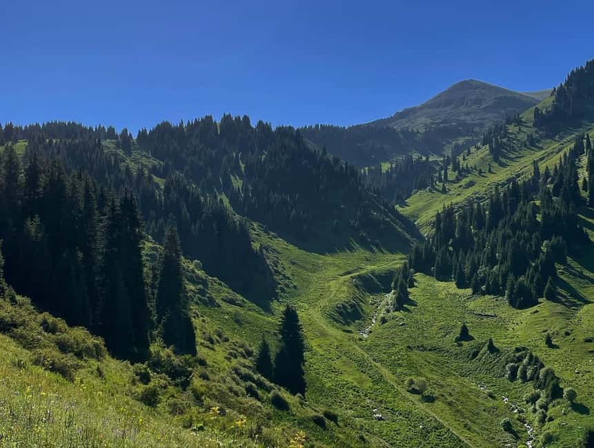
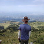
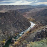
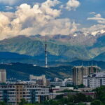
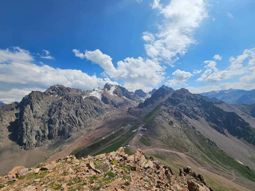
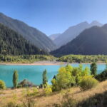
The Four Peaks route near Almaty is built for hikers who want more than a pretty trail. You’re walking in rugged alpine terrain, with a long ridge traverse and multiple summit moments stacked into one day. The payoff is huge: on a clear day, you get wide views over Almaty and out across the Tien Shan—often the kind of panorama that makes you stop talking and just stare.
This hike also has a clear “purpose.” You start lower in the Kim Asar Valley (around 1,845 m), climb to high points topping out near 3,450 m, and then come down comfortably by cable car from roughly 3,200 m. That combo—effort on the ridge, then a practical descent—lets you stay in the mountain zone without turning the day into a punishing marathon of downhill.
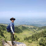
The best part is that the experience is private. This matters because with advanced routes, small choices—your pace, where you take breaks, how you handle exposure or slick sections—can be the difference between a great day and an exhausting one. The guide you’re with is there to keep control of the route and keep you moving safely.
You can also read our reviews of more tours and experiences in Almaty City.


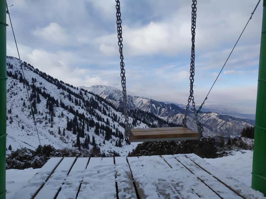
Kim Asar Valley to the Mountain Swings: Your Start Is the Warm-Up
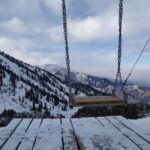
Most days begin with pickup in Almaty and then getting into position for the hike. You start your climbing from the Kim Asar Valley, and the trail gradually rises until you reach the famous “mountain swings.” It’s a fun visual break in the middle of the effort—one of those spots that gives your brain a quick reward while your legs are still getting up to speed.
From there, the route turns into real ascent. You’re working toward Peak Furmanov (3,050 m), and the climb is steady enough to let you settle into a rhythm. This is also where your guide’s approach matters: they’re watching your breathing, your footing, and how you’re reacting to altitude. If conditions are colder or windier, they’ll usually help you adjust clothing layers early rather than waiting until you’re already chilled.
Why this section feels worthwhile: you’re not just ascending into emptiness. Even before the highest viewpoints, you’re gaining perspective on the valleys around Almaty and setting up the later ridge views that make the whole day feel earned.
Furmanov to Panorama: The Ridge Feels Like a Checklist of Views
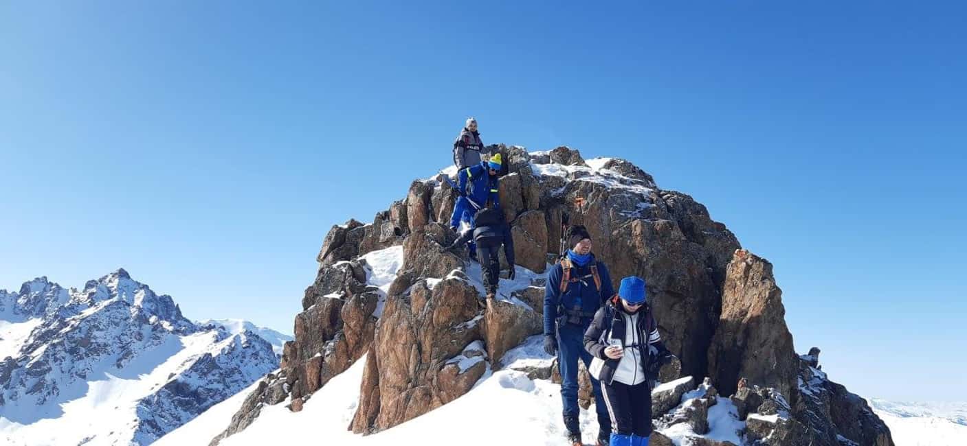
Once you hit Furmanov Peak, the experience starts to shift from “climb” to “move along the mountain.” After summiting, you follow a spectacular ridge toward Panorama Peak (3,200 m). This is a key part of the day because the ridge travel tends to keep you working, even when the trail is manageable. You get a continuous sense of exposure—sometimes thrilling, sometimes tiring—depending on wind and footing.
Panorama Peak is known for sweeping views, and this is where you’ll likely feel the contrast: Almaty is down there, but the high mountains and valleys stretch out in a way that makes the region feel bigger than city life. It’s the kind of viewpoint where you stop counting steps and start reading the terrain—looking for valleys, ridgelines, and the direction the route is taking you next.
Practical note: ridge sections are not where you want to rush. Your guide will help you manage tempo so you don’t blow your energy early. With a total elevation gain up to around 2,000 m, saving some strength for the later higher points is smart planning, not weak thinking.
Bashuta and Chimbulachka: The High Points That Make the Day Worth It
After Panorama, the route continues to Bashuta Peak (3,400 m). This is where the hike earns its reputation as truly advanced. The altitude is higher, the effort feels heavier, and your body starts paying attention to details: your water intake, your warm layer choices, and how steady your footing is.
Bashuta Peak gives you another perspective, often with a sense of being “in the middle” of the Tien Shan viewscape. And even though the day is one long push, reaching Bashuta usually feels like a checkpoint: you’ve made it past the stage where you’re mostly fighting the climb, and you’re now pushing through the high section with clearer payoff ahead.
Then comes the final highlight: Chimbulachka Peak (3,450 m), the highest point on this route. This is the moment advanced hikers wait for. The views from a summit aren’t just about distance—they’re about seeing how the ridge you traveled connects everything. It’s a satisfying mental map of the day.
One reason I like the structure here: even though the hike is tough, it avoids the “one big summit and then you’re done” feeling. You get multiple high points, so the reward doesn’t wait until the end—it shows up repeatedly, then culminates at the top.
Shymbulak Cable Car Finish: When Comfort Comes After Work
After the ridge traverse, you reach the upper Shymbulak cable car station at about 3,200 m. The hike then wraps with a comfortable cable car descent back to the valley area. This finish is a gift. By the time you’re heading down, your legs have already done the heavy lifting, and the cable car helps you recover without turning the day into an all-day crawl.
This also changes how you’ll plan your mindset. Instead of worrying about an endlessly long descent, you can hike with more confidence that the day will end with an easy payoff. It’s not a shortcut—it’s a smart way to get a full summit traverse while still respecting how long the climb is.
You’ll still feel the day afterward, though. Expect fatigue. You earned it. And yes, you’ll probably enjoy the cable car ride more than you think you will while you’re climbing.


Private Safety Support That Matters on Remote Mountain Terrain
This is an advanced hike, and the operator treats safety like part of the itinerary, not an afterthought. The guide carries a GPS navigator, which is important because mobile signal isn’t available on all routes. That matters more than it sounds when weather shifts or visibility changes.
You also get practical equipment support. Trekking poles are provided, which can take pressure off knees and help you stay stable on steeper or uneven segments. On winter days, snow crampons are provided to reduce slipping and fit over winter boots comfortably.
In terms of guiding style, the experience is designed to feel controlled and calm: the team provides full safety support and adapts pace to your abilities. And if you end up with one of the guides associated with this route—names like Victor, Valihan, and Temirlan—you’ll likely notice how they focus on making you feel steady on the trail, not just “taking you uphill.”
English-speaking guidance is included, which is a real advantage on technical days. It helps when you need clear instructions quickly—like where to put your feet, when to slow down, and how to handle wind, snow, or icy patches.
Weather and Season: Winter Reverses the Day, Shoulder Months Need Extra Thought
This hike runs year-round, but the route changes with conditions. In winter, the hike is done in reverse: you ascend by cable car to about 3,200 m, hike up to Chimbulachka, and then descend on foot back toward the Kim Asar Valley. That reversal isn’t just a fun twist—it affects how snow and ice are managed, and it changes where you experience the hardest footing.
In April and November, there’s possible avalanche risk, so route choices and safety decisions become especially important. During April–May and September–November, cable car maintenance periods can affect logistics, meaning timing and exact plan can shift depending on what’s operating.
What this means for you: check the day’s weather and be ready to follow guide instructions without arguing about how the plan should look. On big mountain days, flexibility is not a hassle—it’s part of making the hike safe and enjoyable.
What to Bring (and Who Should Skip This One)
You’ll want to show up prepared, because this is not a “wear anything and hope” hike. Bring:
- Hiking shoes with real traction
- Comfortable hiking clothes plus warm and extra clothing
- Sunscreen, cap, and sunglasses for sunny conditions
- Any personal items you need for altitude comfort (based on your routine)
Fitness-wise, the route is labeled advanced, and you should have good stamina and confidence on mountain terrain. It’s about more than strength—it’s about steady effort over hours at altitude.
It’s also explicitly not suitable for several groups, including:
- Children under 16
- Pregnant women
- People with heart problems
- People over 80
- People with high blood pressure
- People with low level of fitness
If any of those apply to you, don’t try to “test it.” Choose a less demanding hike where safety and pacing match your current limits.
Price and Value: Is $210 Worth It for a Private Advanced Summit Day?
At $210 per person for an advanced private guided hike, you’re paying for a few things that matter on demanding terrain: equipment support, a safety brain on the ground, and private logistics that remove friction from your day.
Here’s where the value shows up in real terms:
- Private guiding with pace control and route safety focus
- Trekking poles included, plus snow crampons when it’s winter
- GPS navigation carried by the guide due to unreliable mobile signal
- Round-trip hotel private transfers within Almaty
- National park area entry tickets (entry depends on the route)
- A small local touch: Kazakh chocolate to keep energy and morale up
What you’ll need to budget separately: lunch and dinner, plus optional insurance if you want extra coverage. Since the day is long, plan food ahead of time so you don’t feel stressed searching for a meal mid-hike.
Is it expensive compared with basic group hikes? Yes. But for an advanced route with four peaks, big elevation gain, and safety tools included, it often feels like paying for less uncertainty. The day runs because the guide and logistics are handled for you, not because you’re improvising.
Should You Book Four Almaty Peaks?
Book it if you want an advanced mountain day with multiple summits, serious elevation gain (up to 2,000 m), and views that reach over Almaty and across the Tien Shan. The private format is especially good if you want a guide who can pace you and keep the route under control in changing conditions.
Skip it (or choose a gentler option) if you’re not comfortable with long effort at altitude, if you’re hoping for an easy walk, or if any of the health/fitness cautions apply. This is a real summit challenge, and the “hard part” is the point.
My practical rule: if you’re training for bigger hikes and you can handle a full day of climbing and ridge walking, this is a strong bet. If you’re still building confidence, there are better steps than jumping straight into four high peaks.
FAQ
How long is the Four Peaks hike?
The hike runs about 10 hours, with the overall duration described as 8–10 hours depending on conditions and pacing.
How difficult is it?
It’s rated advanced, with up to around 2,000 m of elevation gain and a long day with rugged alpine terrain. In winter, the challenge is tougher due to snow and icy sections.
What peaks are included?
The route includes Mountain swings and summits of Furmanov Peak, Panorama Peak, Bashuta Peak, and Chimbulachka Peak.
What’s the distance and starting/ending altitude?
The hike is about 11.5 km (7.1 miles). Altitude is listed as roughly 1,845 m at the start, up to 3,450 m at the highest point, and about 3,200 m at the cable car finish.
Is this a private tour?
Yes. It’s a private, tailor-made experience with a live guide in English.
What equipment is provided?
Trekking poles are provided for each participant. On winter hikes, snow crampons are also provided.
What about mobile signal on the trail?
The guide carries a GPS navigator because mobile signal is not available on all routes.
Is lunch included in the price?
No. Lunch and dinner are not included. Insurance is optional for tourists for an additional fee.